Dingle Peninsula
Kerry
Dingle Peninsula at a glance
- Distance
- 221 km
- Driving time
- 5.5 hoursAllow 1-2 days
- Best direction
- Loop from TraleeEither way round
- Best season
- Spring, Summer and Autumn
- Nearest airport
- Kerry~46 km away
- Fuel estimate
- ~€2514.4 L at €1.75/L
Fuel estimate assumes 6.5 L/100km and an average Republic of Ireland petrol pump price of €1.75 per litre (AA Ireland, July 2026) — see the Ireland fuel price guide for current rates.
About This Route
The Dingle Peninsula (Corca Dhuibhne in Irish) is often called the most beautiful place in Ireland. This wild finger of land reaching into the Atlantic is a stronghold of Irish language and culture, with stunning landscapes that range from golden beaches to rugged mountains.
Why Choose Dingle?
While the Ring of Kerry gets more visitors, many travelers prefer Dingle for its:
- More dramatic scenery - Slea Head Drive rivals any coastal road in the world
- Authentic Irish culture - This is a Gaeltacht area where Irish is the first language
- Fewer crowds - Less tour bus traffic than the Ring of Kerry
- Charming Dingle Town - A vibrant hub with excellent food and traditional music
Where to Stay
This 221km loop starts and ends in Tralee, but the real draw is Dingle Town itself -- the peninsula's only settlement with a proper concentration of restaurants, pubs, and evening life. Basing yourself in Dingle puts you right at the start of Slea Head Drive, within reach of Connor Pass, and close enough to Inch Beach for a morning detour. For a route this compact, one base is all you need, even if you split the drive across two days.
Dingle
Dingle Town is the natural overnight choice. You are steps from the harbour, nightly traditional music sessions, and the peninsula's best seafood restaurants. Slea Head Drive begins just west of town, Gallarus Oratory and Dunquin are a short drive along the coast, and Connor Pass heads north from the eastern edge of the village.
The Slea Head Drive
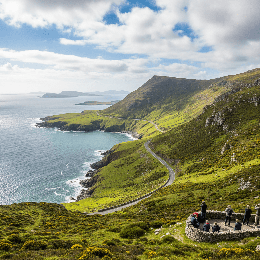
The highlight of the peninsula is the Slea Head Drive, a 30km loop from Dingle Town that should not be rushed. Key stops include:
Dunbeg Fort
A 2,500-year-old Iron Age promontory fort perched on the cliff edge.
Beehive Huts (Fahan)
Mysterious stone structures, possibly early Christian monks' dwellings.
Slea Head
The westernmost point of mainland Ireland with views of the Blasket Islands.
Coumeenoole Beach
A stunning sandy cove surrounded by cliffs, featured in the film "Ryan's Daughter."
Dunmore Head
The true westernmost point of Ireland, with sweeping ocean views.
Beyond Slea Head
Connor Pass
Ireland's highest mountain pass offers breathtaking views of Brandon Bay and the surrounding mountains. Note: Not suitable for nervous drivers or large vehicles.
Inch Beach
A 5km stretch of golden sand, perfect for walking or surfing.
Blasket Islands
Take a ferry from Dunquin to the abandoned Great Blasket Island, former home to a unique Irish-speaking community.
Dingle Town
Don't miss spending time in Dingle Town itself:
- Traditional music - Nightly sessions in pubs like O'Flaherty's and Small Bridge Bar
- Seafood - Fresh catches at restaurants like Out of the Blue
- Fungie the Dolphin - The famous resident dolphin has been visiting the harbor since 1983 (boat trips available)
- Craft shops - Local artisans selling everything from pottery to woolens
Practical Tips
- Drive Slea Head clockwise for the best views and easier driving
- The Connor Pass is not for everyone - If you're nervous about mountain roads, skip it
- Learn some Irish - Locals appreciate any effort to use the language
- Book ahead for restaurants - Dingle's best eateries fill up quickly
- Stay overnight - The evening atmosphere in Dingle is not to be missed
Before You Drive This Route
The Dingle Peninsula is 221km and about 5.5 hours of driving, though 1-2 days is the honest figure once you factor in the stops. Visitors who have never driven on the left should start with driving on the left in Ireland; the Irish roundabout rules guide covers the other thing that catches people out. At this length you will be filling the tank, and where you do it matters more than when — see where to buy fuel in Ireland. Coastal weather changes faster than the forecast admits — the all-season packing guide covers what to have in the boot year-round. Automatic or manual is the decision that catches most visitors out — manual versus automatic has the honest answer for Irish roads. More drives in the same corner of the country are on the County Kerry page, and the Killarney Lakes & National Park pairs naturally with this one.
Frequently asked questions
Tap a question to expand the answer.
QHow long does the Dingle Peninsula take to drive?▼
QCan you drive the Dingle Peninsula in one day?▼
QWhich direction is best to drive the Dingle Peninsula?▼
QIs the Dingle Peninsula suitable for nervous drivers or large vehicles?▼
Need a Car? Try GoCar
Flexible car sharing across Ireland. Get €25 off your first trip.
Register with GoCarCompare car rental options →Hiring instead? You're liable for the first €1,500–€3,000 of damage. Read up on car hire excess insurance before you book.
Fuel stops on this route
Towns on the route with filling stations. Rural stations often close early, so top up before a long empty stretch.
- Tralee
More routes you'll love
Hand-picked drives with a similar vibe.