Mourne Coastal Route
Down
Mourne Coastal Route at a glance
- Distance
- 69 km
- Driving time
- 2.5 hoursAllow 1-2 days
- Best direction
- Newcastle → Warrenpoint
- Best season
- Spring, Summer and Autumn
- Nearest airport
- Belfast City~52 km away
- Fuel estimate
- ~€84.5 L at €1.75/L
Fuel estimate assumes 6.5 L/100km and an average Republic of Ireland petrol pump price of €1.75 per litre (AA Ireland, July 2026) — see the Ireland fuel price guide for current rates.
About This Route
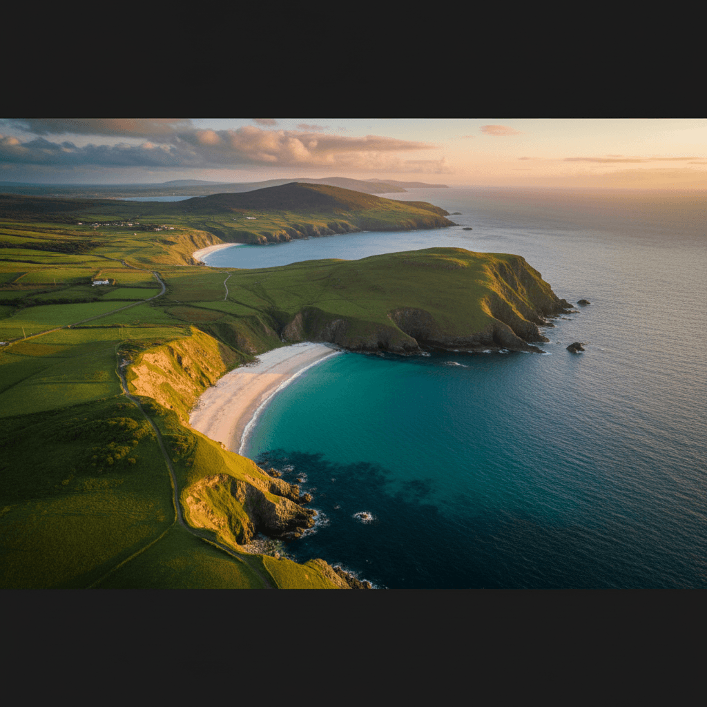
Where the Mountains of Mourne sweep down to the sea - this iconic route follows the coast of County Down with Ireland's most beautiful mountain range as a constant backdrop. C.S. Lewis was inspired by these views; you will be too.
Why This Route?
The Mourne coast offers a perfect combination:
- Mountain drama - The Mournes rise steeply from the shore
- Sandy beaches - Newcastle, Tyrella, and hidden coves
- Historic harbours - Kilkeel and Annalong fishing villages
- Walking access - Trailheads into the Mournes throughout
- Literary connections - C.S. Lewis's inspiration for Narnia
Where to Stay
This 69km coastal route from Newcastle to Warrenpoint follows the foot of the Mournes with optional detours to Silent Valley and Rostrevor. Although driveable in a day, the "1-2 days" duration means many visitors will want an overnight to fit in a Slieve Donard hike or a longer beach stop. Newcastle at the start is the natural single base.
Newcastle
Newcastle has the broadest accommodation range along the Mourne coast, from seafront hotels to family-run B&Bs on the edge of Donard Park. Staying here puts you at the trailhead for Slieve Donard, within walking distance of the beach, and perfectly placed to set off along the coast road to Annalong, Kilkeel, and Rostrevor the following morning. Evening options include the town's restaurants and pubs with mountain views.
The Mountains
The Mourne Mountains are Northern Ireland's highest peaks, with Slieve Donard reaching 850m. Unlike most Irish mountains, they rise dramatically from sea level, creating stunning contrasts.
The famous Mourne Wall - 22 miles of granite built in the early 1900s - traverses the summits and is a remarkable feat of engineering.
The Route
Starting from Newcastle
Begin in this Victorian seaside town at the foot of the Mournes. Donard Park provides the main trailhead for Slieve Donard, while the town offers excellent cafes and restaurants.
Bloody Bridge
A dramatic spot where a river cuts through to the sea. Named after a 17th-century massacre, it's now a peaceful picnic spot and walking trailhead.
Annalong
A working fishing village with a restored corn mill. The harbour is photogenic, and the marine drive beyond offers spectacular views.
Silent Valley Reservoir
A detour inland reveals this beautiful reservoir surrounded by mountains. The visitor centre explains the engineering achievement of supplying Belfast's water.
Kilkeel
The "capital" of the Kingdom of Mourne - a busy fishing port with the largest fleet in Northern Ireland. Fresh seafood is the highlight here.
Cranfield Beach
A hidden gem - a beautiful sandy beach near the point where Carlingford Lough meets the sea. On clear days, the Cooley Mountains in County Louth frame the view.
Rostrevor
A charming Victorian resort town backed by forest. The Cloughmore Stone - a 50-ton glacial erratic - sits on the hillside above, reputedly thrown by the giant Fionn mac Cumhaill.
Warrenpoint
End at this elegant town on Carlingford Lough, with views across to the Republic.
Walking Options
Slieve Donard from Newcastle
- Distance: 9km return
- Time: 4-5 hours
- Difficulty: Challenging
- Highlights: Highest peak in Northern Ireland, panoramic views
Bloody Bridge Coastal Path
- Distance: 4km return
- Time: 1.5 hours
- Difficulty: Easy
- Highlights: River gorge, coastal views
Silent Valley Loop
- Distance: 5km
- Time: 2 hours
- Difficulty: Easy
- Highlights: Reservoir views, mountain backdrop
Practical Tips
- Newcastle gets busy in summer - Arrive early for parking
- Donard summit is serious hiking - Proper boots and waterproofs essential
- Silent Valley has parking charges - But well worth paying
- Kilkeel fish & chips - The freshest you'll find anywhere
- Weather changes quickly - Mountains create their own conditions
For Photographers
- Sunrise over the Mournes from Newcastle beach
- Annalong harbour with fishing boats
- Mourne Wall on the mountain traverse
- Rostrevor forest reflections
Before You Drive This Route
Plan on 1-2 days for the Mourne Coastal Route: the 69km takes roughly 2.5 hours at the wheel, and the rest is why you came. If this is your first drive in Ireland, read driving on the left in Ireland before you collect the car — the first roundabout is not the moment to work it out. This one is entirely in Northern Ireland, so there are no tolls and distances are signed in miles rather than kilometres; the Irish toll roads guide covers the border crossing if you are driving up from the Republic. Coastal weather changes faster than the forecast admits — the all-season packing guide covers what to have in the boot year-round. If you have not booked a car yet, our guide to renting a car in Ireland covers what to choose and what the desk will ask for, and car hire excess insurance explains the excess you will be asked to cover. More drives in the same corner of the country are on the County Down page, and the St Patrick's Trail pairs naturally with this one.
Frequently asked questions
Tap a question to expand the answer.
QHow long does the Mourne Coastal Route take to drive?▼
QCan you drive the Mourne Coastal Route in one day?▼
QWhich direction is best to drive the Mourne Coastal Route?▼
QIs the Mourne Coastal Route suitable for nervous drivers or large vehicles?▼
Need a Car? Try GoCar
Flexible car sharing across Ireland. Get €25 off your first trip.
Register with GoCarCompare car rental options →Hiring instead? You're liable for the first €1,500–€3,000 of damage. Read up on car hire excess insurance before you book.
Fuel stops on this route
Towns on the route with filling stations. Rural stations often close early, so top up before a long empty stretch.
- Annalong
- Rostrevor
- Warrenpoint
More routes you'll love
Hand-picked drives with a similar vibe.