Inishowen 100
Donegal
About This Route
The Inishowen 100 is Ireland's most northerly driving route, circumnavigating the wild Inishowen Peninsula to Ireland's northernmost point at Malin Head. This epic journey offers some of Europe's most dramatic coastal scenery.
Why This Route?
The Inishowen 100 delivers superlatives:
- Ireland's northernmost point - Malin Head
- Stunning beaches - Award-winning strands at Kinnagoe, Pollan, and more
- Historic sites - From Stone Age to Star Wars
- Dramatic cliffs - Dunree Head, Malin Head, Dunaff Head
- Authentic Ireland - Gaeltacht culture in remote communities
The Peninsula
Inishowen (Inis Eoghain - "Island of Eoghan") is a peninsula of superlatives. Bounded by Lough Foyle to the east and Lough Swilly to the west, it points boldly into the Atlantic.
The Route (Clockwise)
Starting from Derry/Letterkenny
Most approach from Derry (Buncrana is 30 minutes away) or Letterkenny via the western shore.
Buncrana
The "capital" of Inishowen - a traditional seaside resort with an excellent beach, castle ruins, and facilities.
Fort Dunree Military Museum
A Napoleonic-era fort perched on dramatic headlands guarding Lough Swilly. The museum covers Irish military history, and the coastal walks are superb.
Gap of Mamore
A dramatic mountain pass with hairpin bends and sweeping views. Not for nervous drivers, but the scenery is extraordinary.
Dunaff Head
Detour to this spectacular headland with sea stacks and blow holes. The strand below is remote and beautiful.
Malin Head
Ireland's most northerly point. The views extend to Fanad, Tory Island, and on clear days, Scotland. Features include:
- Banba's Crown - The actual northernmost point
- Hell's Hole - A dramatic chasm with roaring waves
- WWII signal tower - "Éire" sign visible from aircraft
- Star Wars filming location - Scenes from The Last Jedi
Malin
Ireland's most northerly village, with an attractive green and distinctive church. The Malin Head peninsula beyond feels like the edge of the world.
Glenevin Waterfall
A beautiful 30-foot waterfall hidden in a glen. Short walk from the car park.
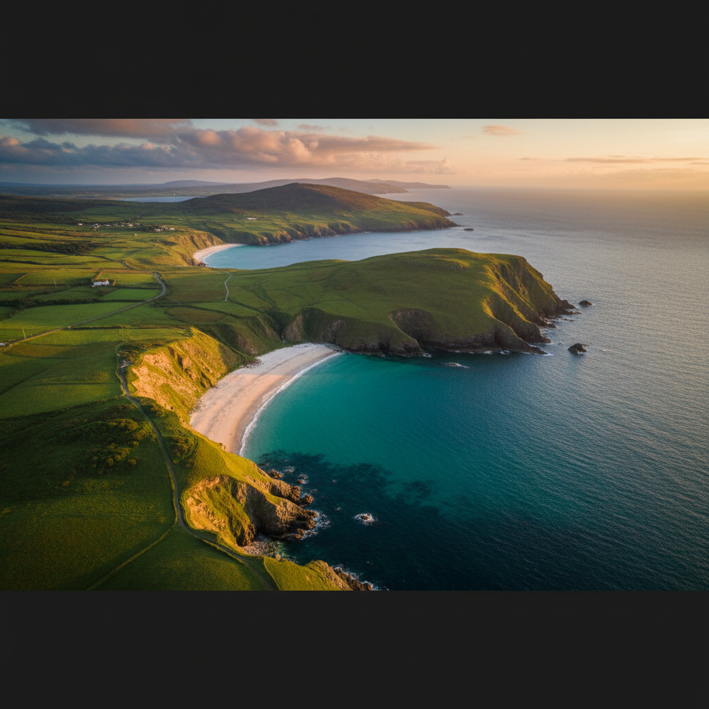
Kinnagoe Bay
A stunning secluded beach backed by dramatic cliffs. The Spanish Armada ship La Trinidad Valencera wrecked here in 1588; artefacts are in the Ulster Museum.
Greencastle
A fishing port with the atmospheric ruins of a 14th-century castle. The Inishowen Maritime Museum tells the peninsula's seafaring story. Ferry to Magilligan in County Derry (summer only).
Stroove & Inishowen Head
Lighthouse and coastal walks on the eastern headland. Views across to Northern Ireland.
Moville
A handsome town on Lough Foyle with a Victorian-era promenade and excellent cafes.
Muff & Border Loop
Return through Muff (yes, it's a real place name) past the Grianan of Aileach.
Grianan of Aileach
An extraordinary stone ring fort on a hilltop, rebuilt to its original 1,700-year-old design. 360-degree views across both loughs. Free access.
Beaches
The Inishowen coast has some of Ireland's finest beaches:
- Pollan Bay - Sheltered family beach near Buncrana
- Five Fingers Strand - Dramatic dune-backed strand
- Lagg Beach - Perfect sand, limited access
- Kinnagoe Bay - Secluded Armada wreck site
- Stroove Beach - Views to Northern Ireland
Practical Tips
- Allow 2-3 days - There's too much to rush
- Gap of Mamore - Check weather; low cloud spoils views
- Malin Head parking - Can be busy in summer
- Fuel up in Buncrana - Remote areas have fewer stations
- Weather changes quickly - Pack layers
Best Seasons
- Late spring/early summer - Longest days, wildflowers
- September - Quieter, autumn light
- Winter - Dramatic but check road conditions
Combining Routes
The Inishowen 100 connects with:
- Derry (20 minutes from Muff)
- Wild Atlantic Way (via Letterkenny)
- Fanad Peninsula (across Lough Swilly)
Need a Car? Try GoCar
Flexible car sharing across Ireland. Get €25 off your first trip.
Register with GoCarCompare car rental options →Recommended fuel stops along this route:
Fuel stations are available in major towns along the route.