Introduction
Maneuvering through the enchanting landscapes of Ireland can often feel like deciphering a green-hued labyrinth. Being lost in the narrow winding roads, amidst those rolling hills and meandering coastlines, might seem like an endearing adventure initially. However, the charm quickly fades away when you unintentionally detour several miles off your itinerary or find yourself stuck in an unexpected traffic snarl, causing significant delays. The predicament could be more challenging if you’re trying to navigate in areas where your standard GPS fails due to poor signal strength or lack of updated route information. This is where top-notch navigation apps step in. In this guide, we have comprehensively compared the best navigation apps like Google Maps, Waze, and various local apps, keeping in mind the unique terrain and challenges of driving in Ireland. Explore the Emerald Isle unhindered, with accurate routing, spontaneous offline access, and real-time traffic alerts at your fingertips with the help of this comprehensive guide to the top navigation apps for your Irish road trip.
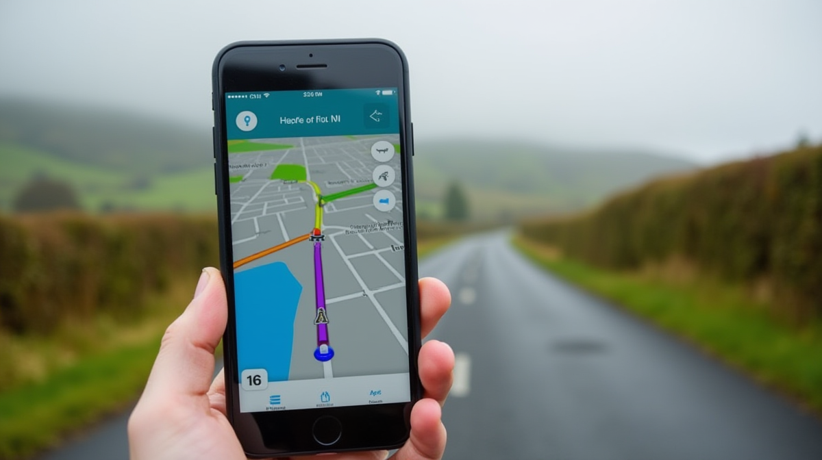
Comparing Google Maps, Waze, and Local Apps
In this section, we’ll deep dive into comparing our three frontrunners: Google Maps, Waze, and Ireland’s local navigation apps. My personal experiences from navigating through the winding, meandering lanes of the beautiful Irish countryside inspired this comparison.
Google Maps
Google Maps is a reliable, widely used navigation app. It offers real-time GPS navigation, traffic, and transit info, and explore local neighborhoods. Also, Google’s interface is top-notch, with clean, user-friendly functionality.
During my own road trips across Ireland from Dublin to Sligo, however, I often encountered areas with poor signal— particularly in more rural locations. Google Maps tends to struggle offline which can be a major drawback. However, you can download maps for offline use prior to your trip, a feature I’ve gladly embraced.
Waze
Waze is another robust navigation app owned by Google. What sets Waze apart is its crowd-sourced traffic information. Users can report accidents, roadblocks, police sightings, and other issues, providing other users with real-time, on-the-ground data.
Yet, there are shortcomings. I learned my lesson the hard way when the software drained my battery during a long journey from Cork to Galway. The intense, real-time updates require more battery usage, so it’s better to keep your device charging while using Waze.
Local Apps
Ireland has developed some powerful local navigation apps like OSi MapGenie and Loc8 Code. The biggest selling point for these: they’re specifically designed to navigate Ireland’s unique road system.
OSi MapGenie, for example, works impressively offline, a lesson I learned when wandering through the remote, signal-less Aran Islands. Meanwhile, Loc8 Code excels in providing precise pinpoint locations.
Comparison Snapshot:
- Offline Functionality: Google Maps & Local Apps triumph here. Google Maps allow pre-downloaded maps, and local apps are more resilient in signal-deficient zones.
- Traffic Updates: Waze definitely takes the cake for real-time, user-generated traffic alerts and updates.
- Battery Usage: Local Apps & Google Maps are less draining on your device’s battery life, an important factor for long Irish road trips.
- Localization: Local Navigation Apps have the edge in terms of local geographical knowledge and precise pinpoint locations.
In summary, the ‘perfect’ navigation app depends on specific user requirements. Google Maps is adequate for most, but if real-time traffic updates are crucial, then Waze is your go-to. On the other hand, if you plan on exploring more remote locations in Ireland, local apps are a game-changer.
Remember, the best road trips are often the product of thorough preparation. Download your apps, prep your device, and get ready to cruise through the Emerald Isle.
For more professional insights, check out Lonely Planet’s tips on mastering the Irish roads, or seek out in-depth reviews on navigation apps at PCMag. Happy journeying!

Understanding Routing and Offline Access
Understanding the intricacies of road maps and offline access to those maps is essential for effective navigation during your Irish road trips. It’s particularly significant for those off-the-grid moments when you find yourself in Ireland’s picturesque yet remote countryside without any access to internet connectivity.
Routing
Routing is the process through which a navigation app guides you from your current location to your desired destination. Different apps make use of various sources of data, including satellite GPS, local authorities and user-contributed information for planning the best possible route. The accuracy, details and utility of these routes can, however, significantly vary.
For instance, Google Maps leverages its extensive database and intricate algorithms, achieving unparalleled accuracy in routing. Google Maps also provides multiple routes to a single destination, which comes in handy when there are roadblocks or heavy traffic.
However, even with its algorithmic prowess and resourceful database, I have faced my fair share of routing failures. I distinctly remember a time when Google Maps suggested a route through a narrow, unpaved countryside road. Lack of real-life user input sometimes leads to such missteps.
On the other hand, Waze, while reliant on Google Maps data, applies a different approach towards route planning. Waze heavily relies on live user input about traffic situations, accidents, and roadblocks. This real-time data contribution by fellow drivers often provides invaluable insights leading to faster routes. However, in less populated areas or amongst less tech-savvy populations, this might lead to inaccurate or outdated routing.
Offline Access
Offline Accessibility is another factor you need to carefully consider while choosing your navigation app. Internet connectivity can be intermittent, especially when you are exploring rural Ireland. An app with a reliable offline mode that lets you download and use maps offline becomes your lifeline in such places.
Google Maps offers downloadable maps that can be used offline for navigation, search, and route planning. But, Google’s offline maps often lack the real-time traffic alerts and detours, which might lead you into traffic snarls.
Waze, on the other hand, doesn’t offer comprehensive offline map features. I learned this the hard way during a drive through the scenic Ring of Kerry, where a loss in connectivity left my Waze app useless.
Government-funded Ordnance Survey Ireland (OSi) provides a detailed map that is highly reliable for offline use. It’s particularly useful for hiking and exploring remote natural sceneries, thanks to its precise topographic details.
In conclusion, the best navigation app for your Irish adventure largely depends on your specific needs. If high-accuracy routing is your priority, Google Maps should be your go-to app. But, if you prefer real-time updates from fellow travelers, Waze would serve you better. And if your travels take you into Ireland’s wilderness, nothing beats the offline utility of OSi. The key is to balance between different features to find the one that works best for you.

Navigating with Traffic Alerts.
With modern technology, travellers have access to a multitude of useful, responsive, and real-time digital navigation tools. These tools, particularly the traffic alert feature, represent a vital assist when exploring the idyllic roads of Ireland and avoid finding yourself stuck in unforeseen traffic situations. Here’s how to make the best use of such tools.
Understanding the Importance of Traffic Alerts
Traffic alerts are an essential feature offered by navigation apps. They provide real-time updates about the conditions of the roads you plan to traverse, displaying notifications about road blockages, accidents, and heavy traffic areas. Timely notifications can save you hours on a trip enabling decisions about detours or stops.
For instance, on a personal road trip around the Ring of Kerry, a timely traffic alert via Google Maps saved us from an hour-long delay due to a road accident. We were able to swiftly reroute, enjoying an unplanned but delightful detour through the beautiful town of Killorglin.
Choosing the Right Navigation App
When it comes to effective journey planning and traffic updates, not all apps are created equal. Based on numerous road trips across Ireland, here are three top-recommended navigation apps:
- Google Maps: Known for its accuracy, Google Maps offers comprehensive traffic updates, providing alternative routes in times of heavy traffic or road blocks. It’s free and does not require an online connection, which is a question of relevance in rural areas where signal coverage can be patchy.
- Waze: Waze excels in its real-time data contributing by users, that includes traffic updates, police presence, and potholes. It does require an internet connection, but if you’re primarily staying in covered areas, it becomes a very reliable choice.
- AA Roadwatch: A local Irish app providing real-time updates about road and traffic conditions. It also features weather updates, which can be highly influential while travelling in Ireland.
Optimal Use of Traffic Alerts
A handy tip, gleaned through numerous trips: keep your app’s notification settings optimized. If traffic alerts are set too frequent, you might miss out on crucial updates amid a flood of minor ones. On another trip to Sligo, we almost missed an important road closure notification as it was drowned in numerous ‘fastest route’ notifications. After that experience, we now keep the alert frequency to ‘important’ or ‘major’ traffic updates, thus ensuring the really crucial updates are never missed.
To sum up, traffic alerts can make your Irish road trip smoother and more enjoyable. It’s crucial to choose the correct app for your trip and keep the notifications optimised. This way, you’ll spend less time in traffic, and more time absorbing the stunning landscapes Ireland has to offer.

Why Local Apps Might Be Your Best Bet
When planning a trip to the Emerald Isle, you might assume common map applications such as Google Maps or Waze have got you covered. However, while these internationally used apps certainly have their benefits, our experiences have proven that local apps can often be the best choice for navigating Ireland. Our team has tried and tested various apps, both local and international, which has led to interesting insights, lessons learned, and the conclusion that local might indeed be the best.
The Advantage of Local Experience
When we used a local app, like “Maps.ie,” we were impressed by the app’s precise knowledge of Ireland’s roads, showing us routes that weren’t recommended by Google Maps or Waze. The reason behind this lies in the local data these apps use. For instance, Google Maps’ algorithms have limited understanding of the often complex local factors such as the narrow country lanes and unexpected road closures due to local events or weather conditions. Local apps, on the other hand, aggregate data from local authorities and drivers, which can lead to the creation of dynamic routings that are not available for other generic mapping apps.
Offline Access
During our drive through the rural wilds of Connemara, we quickly discovered that reliable internet is not something to be taken for granted. This made offline maps crucial. We found that local apps such as Maperitive and ViewRanger offered extensive offline access, including topographical maps, a feature we did not find in mainstream apps.
Credible Traffic Alerts
Irish roads are known for unpredictable traffic due to livestock crossings, local festivals, or even sudden weather changes. From personal experiences, we found that local navigation apps were incredibly efficient in sending out prompt traffic alerts. They provided faster updates than Waze or Google Maps, probably because they source these updates from local radio stations, among other local information channels.
The Human Touch
It’s not all about the tech – it’s also about the human element. Some of our most enjoyable routes resulted from recommendations within the app by local users, who suggested fantastic scenic drives and pointed out spots of interest off the beaten path. This personal touch is something that global navigation apps simply cannot replicate.
We certainly learned vital lessons from our road trip around Ireland; namely, international doesn’t always mean superior. So, if you’re seeking a smooth, enriched, and local experience, consider opting for local navigation apps for your Irish adventure.
Further reading:
Road Safety Authority Ireland
App links:
Maps.ie
Maperitive
ViewRanger

Tips to Effectively Use Your Chosen Navigation App.
Whether you’re on a grand road trip around Ireland or navigating to a new destination, a reliable navigation app can be a lifesaver. Here are some top tips to maximize the effectiveness of your chosen app, no matter if it’s Google Maps, Waze, or a local application.
Pre-Download Offline Maps
An essential tip, especially for road trips along the Irish countryside, is to download offline maps. It’s not uncommon to hit areas with weak or non-existent mobile data. Google Maps allows you to download your desired zones for offline navigation, while Waze only provides offline access for your planned routes. So, pre-plan and pre-download to ensure seamless navigation.
Adjust Your Preferences
Most apps, like Google Maps and Waze, allow you to customize route preferences. You can choose to avoid toll roads or ferries, find the fastest route, or enjoy the most scenic drive. It’s best to familiarize yourself with the settings so you can tailor your journey to your liking.
Stay Updated with Live Traffic
During a trip I did from Dublin to Galway, Waze’s real-time traffic updates saved me from getting stuck in a major snarl-up. These apps rely on user-generated information ensuring real-time accuracy. So, make sure to keep your app updated for the latest traffic alerts.
Monitor Speed Limits
Different apps provide different benefits. For instance, while Google Maps boasts a more comprehensive map database (which becomes useful in local towns), Waze offers speed limit alerts, which were crucial during my trip on Irish roads, known for their strict speed regulations.
Use Augmented Reality (AR) Navigation – If Available
Some local Irish mapping apps have started offering AR navigation, providing a unique, innovative navigation experience. For example, while traveling around Cork, I used this feature on a local app which meant my eyes spent less time glued onto a screen.
Don’t Run Out of Battery
Remember, using GPS heavily drains your battery. Plan for this by carrying a car charger or power bank. Once on a long drive from Belfast to Dingle, my phone died leaving me to resort to traditional map reading, a skill I am, unfortunately, not blessed with, hence the impromptu ‘detour’.
Choose the App that Suits Your Needs
Google Maps, Waze, and local Irish apps each have their unique features. My advice? Use a mix of them. Use Google Maps for its comprehensive mapping, Waze for real-time traffic and alerts, and local apps for their localized insights, especially in rural areas.
In conclusion, utilizing navigation apps isn’t just about following the given directions. It’s about customizing your experience and using the features to their fullest. Continually learning, adapting, and preparing for the journey ahead can make all the difference in having an easy, enjoyable trip.

Conclusion
In conclusion, armed with the right knowledge and tools, your Irish road trip can be transformed from something potentially stressful into an enjoyable and smooth adventure. The appropriate app, whether it’s the global powerhouse Google Maps, the community-driven Waze, or the locally-sourced alternatives, can effectively guide you through the twisting turns, intriguing crossroads, and picturesque byways of the Emerald Isle.
Remember, each app boasts its own unique features – from accurate routing, offline access to real-time traffic alerts – that help ensure a stress-free navigation on your trip. Choosing between them should not be seen as a daunting task, but rather a call to understand your personal travel preferences. Take a moment to consider your individual needs and concerns, for in doing so, the perfect guide to your Irish journey will become apparent.
Navigating new terrains is a quintessential part of the travel experience and having a worthy companion in the form of a reliable navigation app on your Irish road trip can certainly enhance your overall experience. So, go ahead and find your perfect digital companion, soak up the enchanting landscapes, immerse into the rich, cultural charm, and feast your senses as you traverse the irresistible terrain of Ireland.
Finally, always remember not to totally rely on digital platforms. Occasionally, let the excitement of the road inspire you and indulge in impromptu detours, as they could lead to the most unforgettable discoveries. Now it’s over to you – may your Irish journey overflow with unexpected pleasures, stunning panoramas and memorable encounters. Pack your bags, fire up your chosen navigation app, and explore the Emerald Isle with confidence and excitement! Safe travels.


